
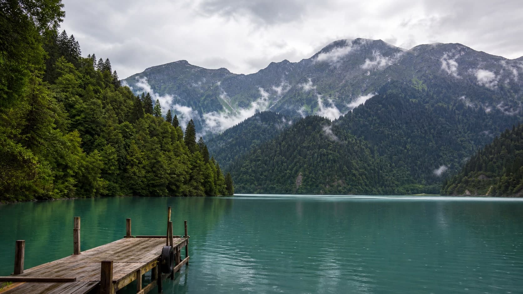
Lake Ritsa: Abkhazia’s mountain mirror
Ritsa is the main highland stop on the Ritsa route, but the day depends on road conditions, weather, visibility and pace. Arrive without rushing, keep a margin for the return and treat the shore as mountain water rather than a resort beach.
After the forest road, the Ritsa basin opens almost suddenly: the water shifts from graphite to green-blue, slopes stand close to the shore and the air feels much cooler than on the coast. Slowing down is more useful here than trying to collect every stop around the lake.
What This Place Is
Lake Ritsa lies in mountainous Abkhazia on the route through the Bzyb gorge. On a map it looks like a single point, but for travellers it is a sequence of decisions: the road, canyon stops, short viewpoints, weather and finally broad water held between slopes.
How to Plan the Route
Most visits follow the same road and stop along the way at Blue Lake: a brief vivid stop on the road to Ritsa and Yupshara Canyon: dramatic road corridor before Ritsa. Avoid placing too many extra stops after the lake: mountain roads, visibility, wet surfaces and traffic density can all change the pace of the day. If weather worsens or the group gets tired, dropping a stop is better than rushing the return.
Time by the Water
Choose one calm viewpoint, walk a little along the permitted shore and leave time simply to pause. By the water it can be cool and windy, and stones or platforms can become slippery after rain. Do not make swimming part of the plan by default: mountain water needs a decision on the spot.
Details
Practical: Ritsa is a mountain outing where time margin, weather and the return drive matter more than a strict schedule.
- Start with a buffer: the road, stops and return often take longer than they seem in the morning.
- Bring a warm layer, rain protection, water and cash for local expenses.
- On the mountain road, stop only where it is safe and permitted.
- Do not overload the day: Blue Lake: a brief vivid stop on the road to Ritsa, Yupshara Canyon: dramatic road corridor before Ritsa and Ritsa already make a full route.
Data updated: 5 July 2026
Route guidance
Want to include this stop in a route?
We can tune "Abkhazia Classic: Lake Ritsa without a rigid timetable" for your dates or suggest a similar route for your group.
Noticed a change?
Suggest a correction for this item
If the road, opening hours, access, or description changed, send a short proposal. Publishing happens only after review.
Part of tour
- OpenAbkhazia Classic: Lake Ritsa without a rigid timetableThe classic route to Lake Ritsa: Abkhazia’s mountain mirror links the canyon, the Blue Lake, the mountain road and a lakeshore pause. It is a popular full-day outing where weather, traffic, entry rules and operating services matter more than exact timing.
- OpenNew Athos and Lake Ritsa in One Day: a full route with marginThe New Athos + Lake Ritsa: Abkhazia’s mountain mirror route suits travellers ready for a long day, significant driving and a flexible schedule. Monastery rules, cave operations, mountain weather, traffic and Ritsa services can all reshape the plan on the day.
- OpenGega Waterfall and Lake Ritsa: a mountain route based on conditionsPlan the route to Gega Waterfall: powerful water and cool air on a mountain road and Lake Ritsa: Abkhazia’s mountain mirror as a flexible mountain day via Blue Lake: a brief vivid stop on the road to Ritsa and Yupshara Canyon: dramatic road corridor before Ritsa: road condition, rain, vehicle suitability and the driver's judgement matter more than a fixed schedule. Keep time margin, grippy shoes and a real backup plan without Gega.
- OpenRitsa in a Private Format: flexibility rather than queue-free promisesA private route to Lake Ritsa: Abkhazia’s mountain mirror gives more space, pacing and choice of stops, but it does not remove weather, traffic, protected-area rules or rental operations. Treat the VIP format as a flexible day, not a guarantee of boats, empty viewpoints or perfect light.
On the way
Directional links: you can stop by or see these from here.
- OpenBlue Lake: a brief vivid stop on the road to RitsaStopoverBlue Lake is a compact roadside stop where the colour can be vivid, but road safety, barriers, wet stones and low-impact behaviour matter more than getting close to the shore.
- OpenYupshara Canyon: dramatic road corridor before RitsaRelatedStopoverThis narrow mountain canyon on the road to Ritsa is best treated as an active traffic corridor: use safe pull-offs, do not step into the carriageway and do not feel obliged to stop in the tightest section.
- OpenLittle Ritsa: a quiet lake reached on footDetourRelatedLittle Ritsa is not a quick add-on to the main Ritsa shore, but a walking route with forest, height gain, cold water and limited infrastructure. Start early, wear grippy shoes, keep descent margin and skip the ascent after rain or in poor visibility.
- OpenMolochny Waterfall: white water and wet stone on the Ritsa roadDetourRelatedMolochny Waterfall is a short damp stop where slippery stone, spray, shoulder space and crowding matter more than promises of a perfect photograph. Plan it as a conditional exterior view with willingness to skip a descent or shorten the pause.
- OpenGega Waterfall: powerful water and cool air on a mountain roadDetourGega is a powerful mountain stop with spray, cool air, slippery stones and variable road access. Plan it with margin for road, weather and the return route, not as a quick guaranteed photo stop.
- OpenAuadhara Alpine Meadows: open highland space above the Ritsa forestDetourRelatedAuadhara Alpine Meadows are open highland terrain above the Ritsa forest, where the visit depends on road access, wind, visibility and current rules. Treat the stop as a low-impact walk on clear ground, not as a guaranteed panorama, picnic lawn or default overnight base.
- OpenMount Agepsta: the high line above RitsaRelatedVisibleAgepsta is a powerful mountain presence above Ritsa, but for most travellers it is safer as a landmark and backdrop than as a spontaneous objective. Any outing above the lakes needs preparation, current route knowledge, weather, daylight and readiness to replace the climb with lower viewpoints.
- OpenMount Atsitska: a jagged ridge above RitsaRelatedVisibleAtsitska is a striking ridge above Ritsa, but not a casual viewpoint or a place to test courage. Use it as a visual landmark from the Ritsa shore and viewpoints, and plan any ridge outing only with clear weather, readable trail and large descent margin.
Related
- OpenRitsa Viewpoint: the lake panorama without rushing the edgeComplementsRelatedThe viewpoint above Ritsa gives a whole-lake view of water, forested slopes and road, but it is a short weather-dependent stop. Wind, wet rock, cloud and the edge of the platform matter more than chasing a perfect photograph.
- OpenApatskha at Ritsa: flexible lake food without a rigid planComplementsRelatedThe apatskha at Ritsa is useful for hot food near the lake when it is operating and not overloaded. Menu, queues, payment, seating and service speed vary, so treat it as a flexible pause with margin for the road.
- OpenStalin's Dacha at Ritsa: dark timber, silence and museum contextHistorical linkRelatedStalin’s dacha at Ritsa is a historical stop in forest by the lake, where the contrast between enclosed interiors and open mountain nature matters. Visit format, tickets, photography, open areas and waiting should be checked on site.
- OpenProshchay Rodina viewpoint: strong name, exposed roadside stopComplementsRelatedProshchay Rodina works as a strong story and exposed roadside viewpoint, not as a place to test the edge. Keep the stop short, treat legends as folklore and place traffic safety above the photograph.
- OpenRitsa Observation Tower: a short climb to another lake angleComplementsRelatedThe Ritsa observation tower gives a quick elevated angle, but a short climb still involves wet steps, wind, mist and limited space at the top. Move calmly, keep children close, do not linger in bad weather and use the Ritsa shore as a fallback.